
This is command line utility which performs three functions:
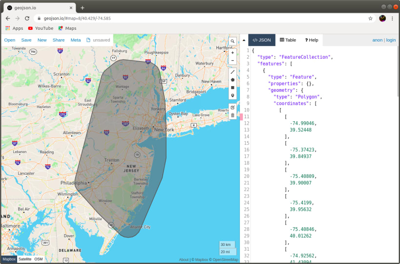
'area' - outputs boundary area encircling a collection of points given the minimum distance from all points in a collection. I used it to generate boundary area for a transit application in Apple Store.
'eqdist' - calculates equidistant point based on three geographic coordinates.
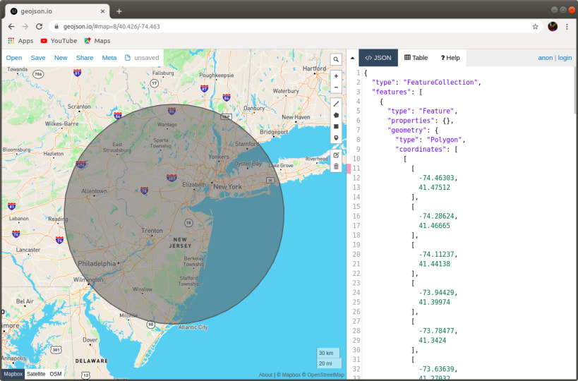
'mincircle' - finds "min circle" (minimum bounding circle) based on a collection of input points. This function uses non-recursive randomized Welzl algorithm, applying it to spherical/geodesic case
Note: You will have to supply sample input in form of .csv files to use this utility. Refer to https://github.com/intheswim/geojson for samples.
You are about to open
Do you wish to proceed?
Thank you for your report. Information you provided will help us investigate further.
There was an error while sending your report. Please try again later.
Snaps are applications packaged with all their dependencies to run on all popular Linux distributions from a single build. They update automatically and roll back gracefully.
Snaps are discoverable and installable from the Snap Store, an app store with an audience of millions.
Snap can be installed from the command line. Open the Konsole terminal and enter the following:
sudo apt update
sudo apt install snapd
To install GeoJSON, simply use the following command:
sudo snap install geojson
Browse and find snaps from the convenience of your desktop using the snap store snap.

Interested to find out more about snaps? Want to publish your own application? Visit snapcraft.io now.
